Sunday, October 28, 2012

Badlands National Park

Badlands #1
This fall, Vickie and I had planned a visit to the North Shore of Lake Superior to attempt to photograph some fall color.  As our departure date got closer, the weather forecasts were becoming increasingly unfavorable, with some forecasts including the possibility of up to a foot of snow.  So, the night before our planned departure, we changed our plans to head to the Black Hills in South Dakota instead.  

On our way back home, we stopped in Badlands N.P. for an afternoon.  I'd always read about how difficult Badlands was to achieve interesting photography in, and so the amount of time that I've spent there in the past has been pretty limited.  But during our brief visit there, we were treated to some nice clouds (fast moving- due to extremely windy and cold conditions!).

Tech info- Canon 40D, 18-55 IS lens, 3 image stitch. 
Badlands #2
Some signs posted along the road into the park warned us not to get near any prairie dogs, because they have been found to be carrying fleas with bubonic plague, so I spent perhaps somewhat less time than usual squatting low over my camera and tripod trying to capture compositional elements in the foreground- but here is one exception.  I was lucky to catch this shot before the fast-moving clouds dimmed the light on this group of wildflowers (or weeds?).

Canon 40D, 18-55mm IS, polarizer.
Badlands #3
I'm considering spending some time this winter processing the above image as a black & white.  All of the photos in this post were taken in the more western part of the loop road through the park, because by the time we worked our way to the eastern section, the light was gone.  Which is a good reason for us to make sure that we come back to this park again someday- when we have much more time to spend!

Monday, October 8, 2012

Great Sand Dunes National Park


Dunes #1-  Clouds over dunes

After a morning of photographing on the dunes, I was hungry for some lunch.  As I headed out of the park to get some food at a nearby restaurant, I was greeted with this view in my rearview mirror of some nice clouds settling over the dunes, so I stopped to grab a few photos.  (I still have a half a roll of exposed Velvia medium format left in my Hasselblad from this spot, that I still need to get developed soon!)

Tech info- Canon 40D, 18-55 IS lens, polarizer (all images in this post)

Dunes #2-  Wildflowers & Dunes

Need your help!  

I've been looking over these images for several weeks trying to decide which, if any, might be suitable for donating to the upcoming Lawson United Methodist Church Auction.  I plan to pick out an image of the mountain wildflowers from my previous blog posts, but I'm not sure how popular any of these images from the Dunes might or might not be.  So, if anyone viewing this post can identify to me an image (identified by the number under the image) that they think might sell well at the Church auction, I'd appreciate the feedback!  You can leave a comment on this blog.


  Dunes #3

Dunes #4

Part of the reason that I'm having more trouble than usual deciding whether I like these images is that several of them are more abstract than most of my usual stuff. 

Dunes #5


Dunes #6

Dunes #7

Dunes #8

One comment- you can see from the relative size of the person in the lower left hand corner of this shot how large these dunes are.  As a matter of fact, I believe that the largest dune in the park is claimed to be about 700 feet tall.  I know this, the angle of repose of the sand, plus the elevation, makes for a tough climb!

I hope you enjoyed viewing these images.  Perhaps they will make some of my viewers want to visit this park someday!

Sunday, August 26, 2012

Wildflowers of the San Juan Mountains (Part 4- Clear Lake)

 Wildflowers- Clear Lake

Tech Info (all images):  Canon 40D, 18-55 IS lens.

     Clear Lake is reached by a 4 wheel drive road that splits off the South Fork Mineral Creek Road just off Highway 550 near Silverton.  According to my map, the lake is at an elevation of about 13,100 ft.  On the afternoon that I visited, it was windy and rainy and the shore of the lake itself was lined with families that were fishing, so I didn't find the lake itself to be particularly worthy of posting photos.  The surrounding basin, however, had some nice patches of wildflowers, as you can see above and below. 
 As you can tell from the sky in the above photo, it was on the verge of raining during my stay at Clear Lake.  Since I remembered that high elevations like this are not wise spots to be standing in the event of lightning strikes (especially not leaning over a conductive tripod!), my visit to this spot was fairly brief.
 Paintbrush- Clear Lake
 bluebells after rain shower

Clear Lake is fairly close to Ice Lake Basin (at least as the crow flies), and also at similar elevation.  It sure is easier to achieve several thousand feet of elevation gain by riding in a four wheel drive Jeep than it is to hike it on foot!

Sunday, August 19, 2012

Wildflowers of the San Juan Mountains - Part 3 (Gold King Basin Area)

Fireweed at Gold King Basin
     Gold King Basin lies on the Telluride side of Ophir Pass.  Despite the fact that it is not frequently mentioned as one of the most prolific producers of wildflowers in the area, during my visit there I found it to have one of the better stands of wildflowers.  I suspect that this may be due to its tendency to shade heavy snowpacks for much of the day, and perhaps this spot was  one of the later areas to melt out during this unusually hot and dry summer, hence the better stand of wildflowers that remained relatively late in the season.

Tech Info- (all images)  Canon 40D, 18-55 IS lens.

 I found the wildflowers to be abundant at this spot- the biggest difficulty in photographing them was keeping from sliding down the relatively steep inclines of the sidewalls of this basin.  More than once I got all set up, only to slide down the hill before I tripped the shutter!

 Paintbrush- Gold King Basin
 During my visit to Gold King Basin, I had the entire basin all to myself.  No worries about people walking into the frame of my photo as I was preparing to shoot.  Sometimes I really enjoy photographing in seclusion- just me, the mountains, and the flowers.  However, at my next stop (Alta Lakes), I did run into several photographers who had not been to Gold King Basin yet, and I was happy to recommend it to them as a worthwhile spot for finding stands of wildflowers.
Pond at Alta Lakes
      Alta Lakes are located only a short distance from Gold King Basin (or perhaps I should say vice-versa, as there were quite a few people busy fishing and camping at Alta Lakes during my visit there.)  I've seen a nice image taken at one of the Alta Lakes, with a clear blue sky and a mountain peak reflecting in the clear blue water.  During my visit there, it was windy and the sky was overcast, but I found the nice group of flowers above beside one of the small ponds, leading me to capture the above image.

Tuesday, July 31, 2012

Wildflowers of the San Juan Mountains (Part 2- Imogene Pass)

 Wildflowers below Imogene Pass

   I had reserved a spot on a tour to Governor Basin, but no one else signed up for this tour, and Brandi at Switzerland of America 4x4 tours in Ouray recommended that I try their tour to Imogene Pass instead.  Since I'd been well satisfied with the previous tour I did with them, I agreed.  Despite the fact that Imogene Pass has seldom been mentioned among the list of best spots for wildflowers in the area, this turned out to be one of the better spots that I saw on my trip.  The driver and guide, Michael, took us on a small side trail just off of the main trail to Imogene Pass that had some nice flower displays, as pictured above.


 Indian Paintbrush below Imogene Pass


Larkspur below Imogene Pass

Group of Paintbrush

Paintbrush and Columbine- below Imogene Pass

Bluebells and other (unidentified) wildflowers below Imogene Pass

Wildflowers below Imogene Pass


   Thanks again to Brandi, Michael (tour guide) and the rest of the fine folks at Switzerland of America in Ouray for a great tour!  I'd highly recommend them- and they are nice folks too!


Stay tuned for my next post, which will cover my (long) hike to Ice Lake Basin.

Sunday, July 29, 2012

Wildflowers of the San Juan Mountains (Part 1)

The view down the valley- Yankee Boy Basin


   The San Juan mountains of Colorado are well-known among nature photographers for being prime locations to photograph wildflowers in the mountains.  Typically, two of the best spots are Yankee Boy Basin (located near Ouray) and American Basin (located between Silverton and Lake City).  In most years, the peak of the wildflower bloom in these spots occurs around the third week of July.
   This May, I made my decision that I wanted to see these areas firsthand and try my luck at capturing the wildflower bloom in my photographs.  I made all the necessary travel arrangements and scheduled vacation time-off from work beginning the week of July 16.  You can imagine my concern when I began to read reports in the nature photography forums around July 1 that the flowers at these locations were already at peak, and fading fast.  My travel plans were already made, and so I resolved to live with them and see if I could manage to get some decent photos, even if it meant changing exactly what I shot and where.
   
Waterfalls, Yankee Boy Basin


   It is the network of abandoned mining trails in the San Juans that make many of these high elevations relatively accessible to visitors and photographers.  Few of these trails can be negotiated in a regular passenger car; most have some very narrow one-lane sections and hairpin curves which require experience and caution, even in high-clearance four wheel drive vehicles.  Since I was unfamiliar with the area, I decided to take a couple of tours to the spots that are covered by local 4x4 tour companies before I rented a Jeep to get to the areas where tour companies don't go.
   I'd seen photos taken by others in previous years which showed thick, dense, carpets of wildflowers in Yankee Boy Basin.  By the time of my arrival at this spot (July 19, 2012), all the flowers that remained were small, isolated patches located close to streams.


Yankee Boy Basin (July, 2012)


   Despite the limited quantity of flowers left at Yankee boy Basin, our driver and tour guide, Dave, (with Switzerland of America in Ouray) managed to surpass my expectations by taking us on a slight detour into Governor Basin on the return.
    
Governor Basin


   The trail to Governor Basin splits off the Camp Bird Road which goes to Yankee Boy Basin, and climbs through a series of switchbacks along narrow ledges with steep drop-offs, over a rough and rocky trail.  Most of the local Jeep rental companies forbid taking their rental Jeeps into Governor Basin.  Governor Basin is also at higher elevation than Yankee Boy.  This year, I found the wildflowers at Governor Basin to be much more prolific and in better shape.


Governor Basin

Larkspur, Governor Basin


   Although I have many more locations and photos to add to this blog, I am going to split it into several separate posts, so that it will not take viewers an excessively long time to open the post for viewing.  Stay tuned for part 2, coming soon!

Sunday, July 1, 2012

Mt. Rainier National Park

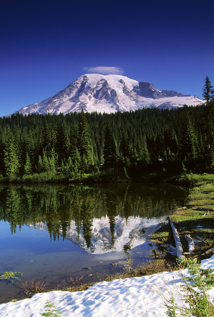
                Wildflowers at Reflection Lake
     Mt. Rainier National Park is a great spot for landscape photographers, particularly when the wildflowers bloom.  The challenge is figuring out ahead of time when the flowers will be at their peak.   I've gone to Mt. Rainier twice hoping to photograph the wildflower bloom, but both times I was too early, and the best areas for wildflowers were still under snow.


The photograph above was taken at Reflection Lake, which is still pretty much covered with snow and ice in the photo above.  This lake is near the area called Paradise, which is the trailhead for many of the best wildflower spots.  The photo below was taken at the same lake just a little ways along the shore on a different year when the snow melt was further along.


                    Calm Morning at Reflection Lake


                              Mt. Rainier along Stevens Canyon Road


   The snow melt (and the wildflower bloom) progresses from the lower elevations, such as the photo above, to the higher elevations.  However, it is the higher elevations that tend to produce some of the more spectacular blooms, perhaps partly due to the greater abundance of moisture.


   The photo above is noteworthy in that the cloud cap shown in this photo formed on the first day of our first visit there.  By a couple of hours later in the morning, this cloud cap grew and grew until it was some of the heaviest and most dense fog that you can imagine.  If memory serves me correctly, it stayed so foggy for the rest of our stay on that trip that we never got another chance to see the mountain.


                             Mt. Rainier from Sunrise Area
     The Sunrise entrance to Mt. Rainier is on the west side of the park.  On our second visit to the park, although the trails around Paradise were still fully snow covered in mid-August, I was able to find these few flowers around the Sunrise area. 


                            Mt. Rainier framed by pines- Sunrise area trail
     The above photo was taken from one of the trails around the Sunrise entrance to the park.  It seems to be considerably drier climate in this area than around Paradise, possibly because the Sunrise area may be in the rain shadow of the mountain.  This could also account for why the trails above the Paradise visitor center have a reputation for producing a more prolific wildflower bloom.  During our visit, then Vice-President Al Gore was in the local news for making an un-announced climb to the top of the mountain.  In all candor, I'm not sure that I've ever been in good enough physical condition to be able to make that climb and back.  Even climbing modest ridges for photos in the Sunrise area was enough to have me huffing and puffing for breath in the thin air!


                             Christine Falls- Mt. Rainier N.P.


     Of course, there is a lot of other scenery to photograph in Mt. Rainier National Park besides wildflowers.  This park has many, many waterfalls, including the one pictured above.  On the last day of our visit during my most recent trip here, I hiked several miles above Christine Falls, until I ran into such heavily snow-packed trails that I decided to turn back.


   Both Vickie and I consider Mt. Rainier to be one of our favorite parks.  I'm hoping that someday we can return for a longer stay, and enable us to catch the wildflower bloom at it's peak!  I hope my friends who view these pages can someday have a chance to visit there, too!  


Bill

Saturday, June 9, 2012

Monument Valley Tribal Park

                                        Tear-drop Arch

                             Monument Valley is located on the border between Arizona and Utah.  It belongs to the Navajo Nation, but visitors are able to drive through the park on a specific road.  To visit other sections of the park, it is necessary to hire a local guide, which are easy to find at the visitor's center.  Tear-drop arch is one of the sites that requires a Navajo guide to visit.  It is best lit in the late afternoon.


Tech details:  Nikon F3, 24-55 mm Nikkor zoom, Fujichrome Velvia, film scan.

                   Sandstone monoliths


Tech Info:  Mamiya 645, 45mm lens, Polarizer, Fujichrome Velvia, film scan.


                                         Mittens- Sunset

     The mittens are probably the most well-known monoliths in Monument Valley, having been photographed in several western movies as well as television commercials.  Favorite times of the day to photograph these buttes are sunrise and sunset, especially if there are picturesque clouds present to catch the warm light.  On this evening, we had spent a long day out photographing, and were getting hungry.  On the way back to our room, we stopped at a small restaurant outside of the park and had a Navajo Beef platter.  It was one of the most delicious foods that I've ever had, but on my next visit to the area, I found that the restaurant had closed.  I hope that some day, I can find another restaurant in the area that serves a dish as good as that one!     


   If any of my Facebook friends have a chance to visit this area, I would highly recommend it as one of the most photogenic and enjoyable areas in the Southwest.                        

Sunday, June 3, 2012

White Sands National Monument

Afternoon in the sun, on the dunes of White Sands


   After my younger daughter Christine's High School graduation (well over a decade ago), she requested that I take her on a photo trip to the southwest.  She wanted to go to New Mexico, I think partly because some of her friends had told her how cool Taos was.  We decided to see White Sands on the way, and here are a few shots that we took there.  The dunes of White Sands are made of gypsum, a mineral that is entirely different from the silica sands that one usually finds at beaches or other areas of the Southwest.  To me, White Sands has a sort of stark beauty that is different from other deserts.  For the photographers out there, when photographing white sand or snow, it is usually advisable to add at least a stop of extra exposure above what a light meter calls for, since the meter is calibrated to provide only 18% reflectance, or neutral gray. 


Christine photographing at White Sands


   We spent an enjoyable afternoon photographing in the dunes, and then as nightfall approached, I captured the image below as the moon rose in the East.  Notice that Christine takes instruction well- she's using a tripod, just like Dad told her!


Tech info (All images):  Nikon F3, 70-300mm Nikkor zoom, Fujichrome Velvia, film scan.


Moonrise- White Sands National Monument 


Friday, May 18, 2012

Antelope Canyon- Page, Arizona


                              Lightbeam- Antelope Canyon

    Antelope Canyon is a very popular and very photogenic slot canyon located near Page, Arizona.  It is located on land owned by the Navajo Nation.  To visit the site, one can either hire a Navajo guide at the road, or there are several guide services in the town of Page which will transport you from downtown to the canyon, plus show you the ins-and-outs of the location.  There are actually two separate canyons, called upper and lower.  The photos shown here are all taken at Upper Antelope Canyon.  This is the more frequently visited of the two, and one can walk through its entire length without any climbing or obstacles (other than an occasional sidewinder rattlesnake that might hide in the shadows now and then).  I've also noticed black widow spiders on the walls in spots, so be alert.  The lower canyon is reputed to be a bit more difficult to negotiate, and is less popular with tourists (although many photographers extoll its virtues).
   If you visit Antelope Canyon with the intent of photographing, the most critical things that you need are a sturdy tripod and a cable release, because it is relatively dark in many parts of the canyon, and long time exposures will definitely be required.  (And don't even consider using flash, or all the beautiful natural lighting, which is the whole point of this spot, will be completely overpowered.)


Tech Info:  Mamiya 645, 45 mm lens, Fujichrome Velvia, scanned transparency

                   Near the entrance to Antelope Canyon
   Early in the morning, the area near the entrance is pretty much dark, and the best light is found at the far end of the canyon.  Later in the morning, the sunlight moves further toward the entrance.  The images above were taken late in the morning


Tech Info:  Mamiya 645, 45mm lens, Fujichrome Velvia, scanned transparency

   Getting optimum exposures here can be a bit tricky, especially with transparency film.  I used spot metering to try to estimate a neutral gray exposure, then bracketed exposures both directions from that setting in half-stop increments for a couple of stops.  My only visit to this spot was in the B.D. era (before digital).  I'd like to go back again someday and try this spot with digital equipment.  Actually, I'd just like to go back again, period, regardless of the circumstances!!

Tech Info:  Nikon F3, Nikkor 24-55mm zoom, Fujichrome Velvia, scanned transparency

Depending on one's tastes, you can make relatively abstract images like the one above by using longer focal length lenses and aiming up higher into the canyon.  These more abstract images are especially found at the far end of the canyon, earlier in the morning.


Tech Info:  Nikon F3, Nikkor 70-300 zoom, Fujichrome Velvia, scanned transparency


I hope all you visitors to my blog will someday be able to visit this spot in person.  In the meantime, I hope you've enjoyed viewing these images.
Bill